
Αρχείο:ISS-30 Lake Fitri, Chad.jpg
Μέγεθος αυτής της προεπισκόπησης: 800 × 531 εικονοστοιχεία . Άλλες αναλύσεις: 320 × 213 εικονοστοιχεία | 640 × 425 εικονοστοιχεία | 1.024 × 680 εικονοστοιχεία | 1.280 × 850 εικονοστοιχεία | 2.560 × 1.700 εικονοστοιχεία | 4.288 × 2.848 εικονοστοιχεία.
Εικόνα σε υψηλότερη ανάλυση (4.288 × 2.848 εικονοστοιχεία, μέγεθος αρχείου: 6,37 MB, τύπος MIME: image/jpeg)
|
|
Αυτό το αρχείο και η περιγραφή του προέρχονται από το Wikimedia Commons. Οι πληροφορίες από την σελίδα περιγραφής του εκεί εμφανίζονται παρακάτω. |
Σύνοψη
| Περιγραφή |
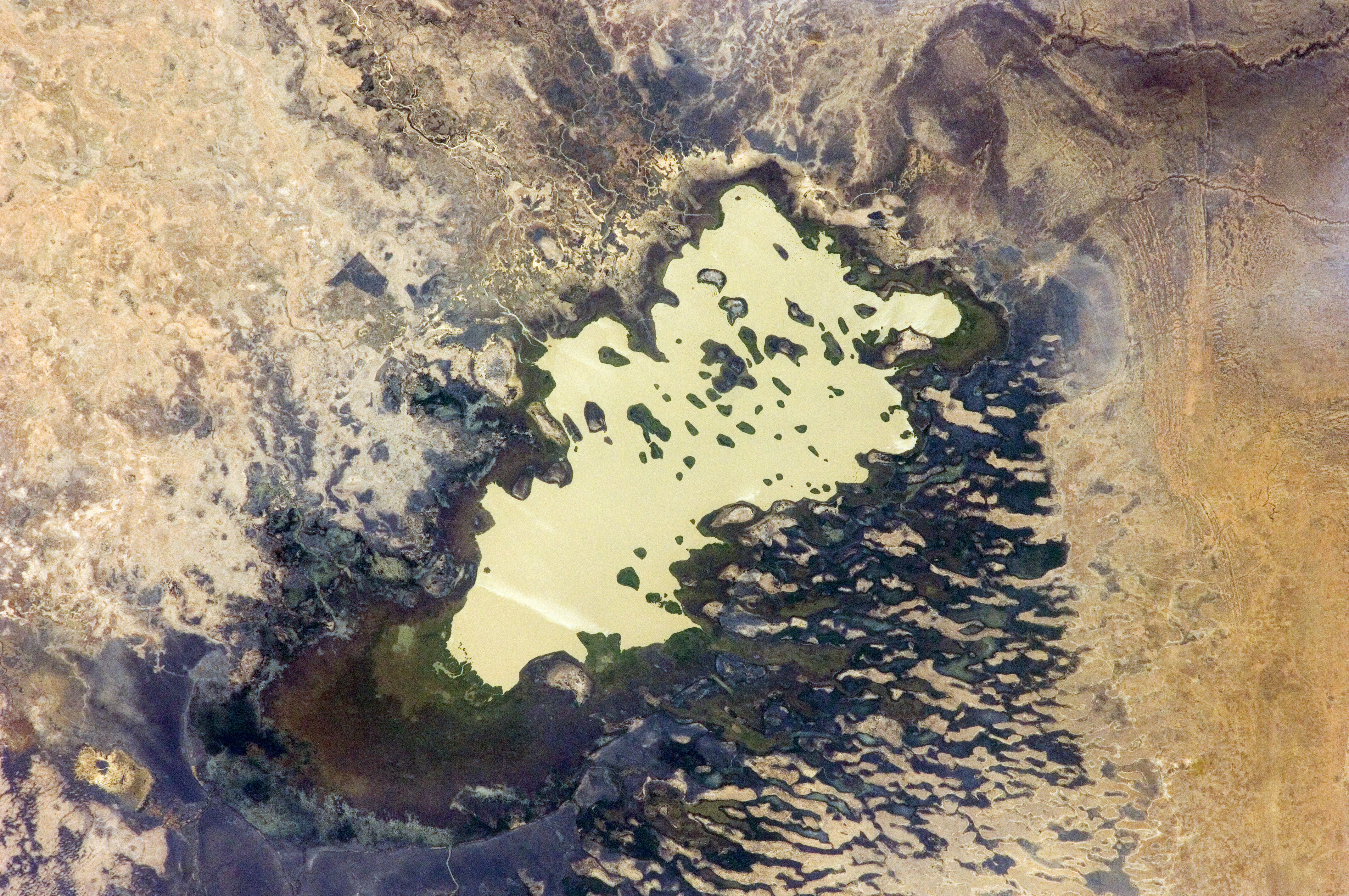
English: Lake Fitri, Chad is featured in this image photographed by an Expedition 30 crew member on the International Space Station.
|
| Ημερομηνία | |
| Πηγή | http://spaceflight.nasa.gov/gallery/images/station/crew-30/html/iss030e059398.html |
| Δημιουργός | NASA |
This image or video was catalogued by Johnson Space Center of the United States National Aeronautics and Space Administration (NASA) under Photo ID: ISS030-E-059398. This tag does not indicate the copyright status of the attached work. A normal copyright tag is still required. See Commons:Licensing. Other languages:
|
Αδειοδότηση
This file is in the public domain in the United States because it was created by the Image Science & Analysis Laboratory, of the NASA Johnson Space Center. NASA copyright policy states that "NASA material is not protected by copyright unless noted". (NASA media use guidelines or Conditions of Use of Astronaut Photographs).
Photo source: ISS030-E-59398.
|
Ιστορικό αρχείου
Κλικάρετε σε μια ημερομηνία/ώρα για να δείτε το αρχείο όπως εμφανιζόταν εκείνη τη στιγμή.
| Ώρα/Ημερομ. | Μικρογραφία | Διαστάσεις | Χρήστης | Σχόλια | |
|---|---|---|---|---|---|
| τελευταία | 20:00, 20 Απριλίου 2016 | | 4.288 × 2.848 (6,37 MB) | Ras67 | new rendered in high quality from NASA's raw image data |
| 12:46, 4 Ιουνίου 2012 |  | 4.288 × 2.848 (2,03 MB) | Ras67 | levels | |
| 17:59, 21 Φεβρουαρίου 2012 |  | 4.288 × 2.848 (1,76 MB) | Ras67 | {{Information |Description ={{en|1=Lake Fitri, Chad is featured in this image photographed by an Expedition 30 crew member on the International Space Station. Lake Fitri is an endorheic, or terminal lake in a desert basin in the southern Sahara Desert. |
Συνδέσεις αρχείου
Τα παρακάτω λήμματα συνδέουν σε αυτό το αρχείο:
Καθολική χρήση αρχείου
Τα ακόλουθα άλλα wiki χρησιμοποιούν αυτό το αρχείο:
- Χρήση σε ar.wikipedia.org
- Χρήση σε arz.wikipedia.org
- Χρήση σε be.wikipedia.org
- Χρήση σε cv.wikipedia.org
- Χρήση σε de.wikipedia.org
- Χρήση σε en.wikipedia.org
- Χρήση σε es.wikipedia.org
- Χρήση σε fr.wikipedia.org
- Χρήση σε id.wikipedia.org
- Χρήση σε it.wikipedia.org
- Χρήση σε ka.wikipedia.org
- Χρήση σε lt.wikipedia.org
- Χρήση σε my.wikipedia.org
- Χρήση σε nl.wikipedia.org
- Χρήση σε pl.wikipedia.org
- Χρήση σε ru.wikipedia.org
- Χρήση σε uk.wikipedia.org
- Χρήση σε vi.wikipedia.org
- Χρήση σε www.wikidata.org