
Αρχείο:Vinson-Map.jpg

Μέγεθος αυτής της προεπισκόπησης: 626 × 599 εικονοστοιχεία . Άλλες αναλύσεις: 251 × 240 εικονοστοιχεία | 501 × 480 εικονοστοιχεία | 802 × 768 εικονοστοιχεία | 1.070 × 1.024 εικονοστοιχεία | 2.139 × 2.048 εικονοστοιχεία | 3.207 × 3.070 εικονοστοιχεία.
Εικόνα σε υψηλότερη ανάλυση (3.207 × 3.070 εικονοστοιχεία, μέγεθος αρχείου: 5,48 MB, τύπος MIME: image/jpeg)
|
|
Αυτό το αρχείο και η περιγραφή του προέρχονται από το Wikimedia Commons. Οι πληροφορίες από την σελίδα περιγραφής του εκεί εμφανίζονται παρακάτω. |
| Περιγραφή |
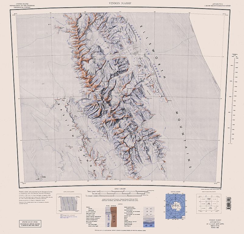
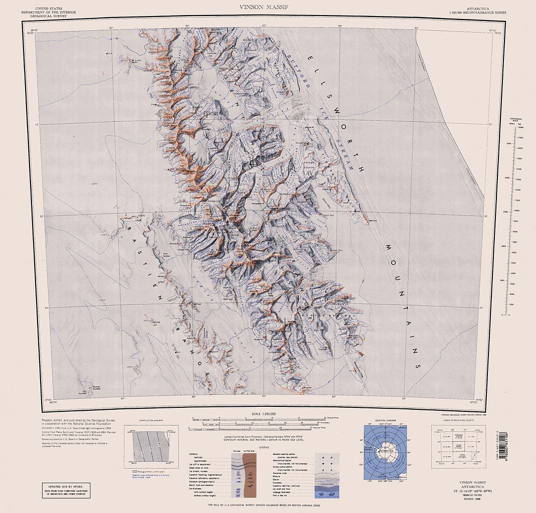
English: Map of Antarctica by the United States Antarctic Resource Center of the US Geological Survey (USGS). |
| Ημερομηνία | |
| Πηγή | https://usarc.usgs.gov/drgs/dir1/c78082s1.jpg |
| Δημιουργός | United States Department of the Interior: Geological Survey |
| άλλες εκδόσεις |
Trimmed and updated version of Wikimedia Commons Image:C78082s1_Ant.Map_Vinson_Massif.jpg. |
This image is in the public domain in the United States because it only contains materials that originally came from the United States Geological Survey, an agency of the United States Department of the Interior. For more information, see the official USGS copyright policy.
|
Ιστορικό αρχείου
Κλικάρετε σε μια ημερομηνία/ώρα για να δείτε το αρχείο όπως εμφανιζόταν εκείνη τη στιγμή.
| Ώρα/Ημερομ. | Μικρογραφία | Διαστάσεις | Χρήστης | Σχόλια | |
|---|---|---|---|---|---|
| τελευταία | 16:25, 22 Ιανουαρίου 2014 | | 3.207 × 3.070 (5,48 MB) | Apcbg | Updated with data from SCAR Composite Gazetteer of Antarctica and other sources. |
| 07:11, 27 Αυγούστου 2013 |  | 3.207 × 3.070 (5,47 MB) | Apcbg | Updated with data from SCAR Composite Gazetteer of Antarctica and other sources. | |
| 16:34, 9 Ιουλίου 2011 |  | 3.207 × 3.070 (5,46 MB) | Apcbg | Updated with data from SCAR Composite Gazetteer of Antarctica and other sources. | |
| 17:34, 8 Μαρτίου 2011 |  | 3.207 × 3.070 (5,47 MB) | Apcbg | Updated with data from SCAR Composite Gazetteer of Antarctica and other sources. | |
| 16:52, 13 Οκτωβρίου 2010 |  | 3.207 × 3.070 (5,45 MB) | Apcbg | Updated with data from SCAR Composite Gazetteer of Antarctica and other sources. | |
| 10:27, 30 Ιανουαρίου 2007 |  | 3.207 × 3.070 (5,4 MB) | Apcbg | Map of Antarctica by the United States Antarctic Ressource Center of the US Geological Society. Trimmed version of Wikimedia image C78082s1_Ant.Map_Vinson_Massif.jpg {{PD-US}} Copyrights and Trademarks USGS-authored or produced data and information are |
Συνδέσεις αρχείου
Τα παρακάτω λήμματα συνδέουν σε αυτό το αρχείο:
Καθολική χρήση αρχείου
Τα ακόλουθα άλλα wiki χρησιμοποιούν αυτό το αρχείο:
- Χρήση σε ar.wikipedia.org
- Χρήση σε ast.wikipedia.org
- Χρήση σε az.wikipedia.org
- Mirovyane zirvəsi
- Zimornitsa zirvəsi
- Fuça zirvəsi
- Bezden zirvəsi
- Oreşak zirvəsi
- Qolemani zirvəsi
- Marsa buzlağı
- Patleyna buzlağı
- Embree buzlağı
- Kopsis buzlağı
- Padala buzlağı
- Ellen buzlağı
- Fonfon buzlağı
- Gerila buzlağı
- Rumyana buzlağı
- Delyo buzlağı
- Burdenis buzlağı
- Arapya buzlağı
- Pulpudeva buzlağı
- Mamarçev zirvəsi
- Rutford
- Χρήση σε bg.wikipedia.org
- Χρήση σε ca.wikipedia.org
- Χρήση σε ceb.wikipedia.org
Δείτε περισσότερη καθολική χρήση αυτού του αρχείου.