
Αρχείο:Vilnius 1576.jpg
Εικόνα σε υψηλότερη ανάλυση (2.667 × 1.973 εικονοστοιχεία, μέγεθος αρχείου: 1,76 MB, τύπος MIME: image/jpeg)
|
|
Αυτό το αρχείο και η περιγραφή του προέρχονται από το Wikimedia Commons. Οι πληροφορίες από την σελίδα περιγραφής του εκεί εμφανίζονται παρακάτω. |
| Περιγραφή |
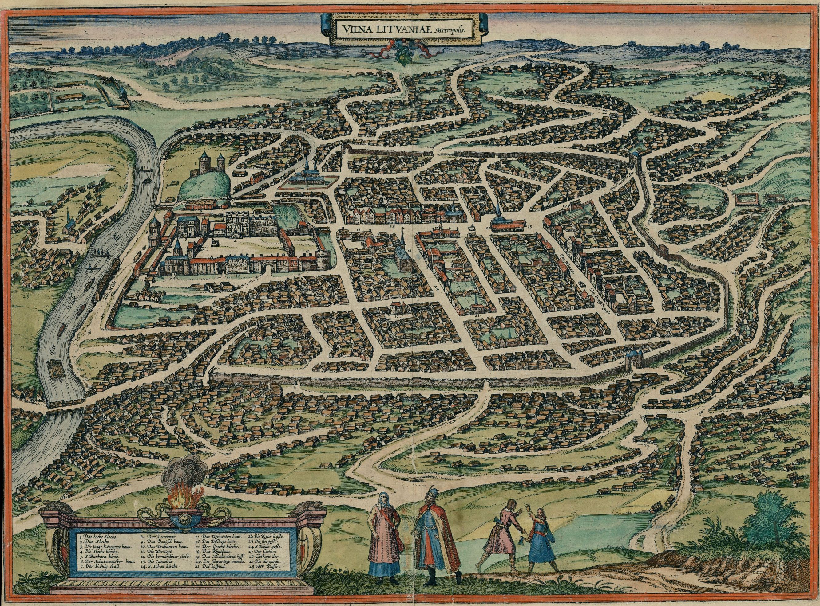
English: Map of Vilnius in 1576
Deutsch: Karte der Stadt Vilnius (als Vilna Lituaniae, Metropolis), 1576
Lietuvių: Vilniaus žemėlapis (lot. Vilna Lituaniae, Metropolis) 1576-ais metais |
| Ημερομηνία | Drawn 1576; published in 1581 |
| Πηγή |
Original publication: Cities of the World (Civitates orbis terrarum. Koeln, 1581. T.3) Digital file: Historic Cities Center of the Department of Geography, the Hebrew University of Jerusalem and the Jewish National and University Library. |
| Δημιουργός | German cartographer and church diplomat G. Braun (1541-1622) and his assistants |
| Άδεια (Επαναχρησιμοποίηση αυτού του αρχείου) |
public domain (pd-old) |
| άλλες εκδόσεις |
 |
|
Αυτό το έργο είναι κοινό κτήμα στη χώρα προέλευσής του και άλλες χώρες και περιοχές όπου η διάρκεια πνευματικών δικαιωμάτων είναι όσο η ζωή του δημιουργού και μέχρι 70 χρόνια μετά ή λιγότερο.
| |
| Αυτό το αρχείο έχει χαρακτηριστεί ως απαλλαγμένο από γνωστούς περιορισμούς βάσει της νομοθεσίας περί πνευματικής ιδιοκτησίας, περιλαμβανομένων όλων των συναφών και συγγενικών δικαιωμάτων. | |
| Annotations | This image is annotated: View the annotations at Commons |
Ιστορικό αρχείου
Κλικάρετε σε μια ημερομηνία/ώρα για να δείτε το αρχείο όπως εμφανιζόταν εκείνη τη στιγμή.
| Ώρα/Ημερομ. | Μικρογραφία | Διαστάσεις | Χρήστης | Σχόλια | |
|---|---|---|---|---|---|
| τελευταία | 02:47, 22 Δεκεμβρίου 2010 | | 2.667 × 1.973 (1,76 MB) | Renata3 | http://historic-cities.huji.ac.il/lithuania/vilnius/maps/braun_hogenberg_III_59.html |
| 03:37, 18 Ιανουαρίου 2009 |  | 1.200 × 866 (549 KB) | Renata3 | http://portal.unesco.org/ci/photos/showphoto.php/photo/4065/size/big | |
| 17:42, 10 Απριλίου 2005 |  | 500 × 360 (81 KB) | Jcornelius | *Description: Vilnius 1576 *License: public domain (pd-old) {{PD-old}} |
Συνδέσεις αρχείου
Τα παρακάτω λήμματα συνδέουν σε αυτό το αρχείο:
Καθολική χρήση αρχείου
Τα ακόλουθα άλλα wiki χρησιμοποιούν αυτό το αρχείο:
- Χρήση σε af.wikipedia.org
- Χρήση σε azb.wikipedia.org
- Χρήση σε be.wikipedia.org
- Χρήση σε da.wikipedia.org
- Χρήση σε de.wikipedia.org
- Χρήση σε en.wikipedia.org
- Χρήση σε es.wikipedia.org
- Χρήση σε et.wikipedia.org
- Χρήση σε hy.wikipedia.org
- Χρήση σε it.wikipedia.org
- Χρήση σε lt.wikipedia.org
- Χρήση σε lt.wikibooks.org
- Χρήση σε lv.wikipedia.org
- Χρήση σε nl.wikipedia.org
- Χρήση σε nn.wikipedia.org
- Χρήση σε no.wikipedia.org
- Χρήση σε ru.wikipedia.org
- Χρήση σε szy.wikipedia.org
- Χρήση σε uk.wikipedia.org
- Χρήση σε zh.wikipedia.org